The geographical makeup of the United States is incredibly diverse. And when it comes to elevation, this is also a country of variety and extremes. Almost 20,000 feet separate the highest point, in Alaska, and lowest, in Florida. Here we’ve compiled a definitive list of the highest elevation in all 50 states. These places are likely to be of particular interest to highpointers, a group of adventurists whose mission it is to visit all 50 of these locations.
Alabama
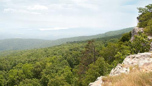
Cheaha Mountain – 2,407 feet
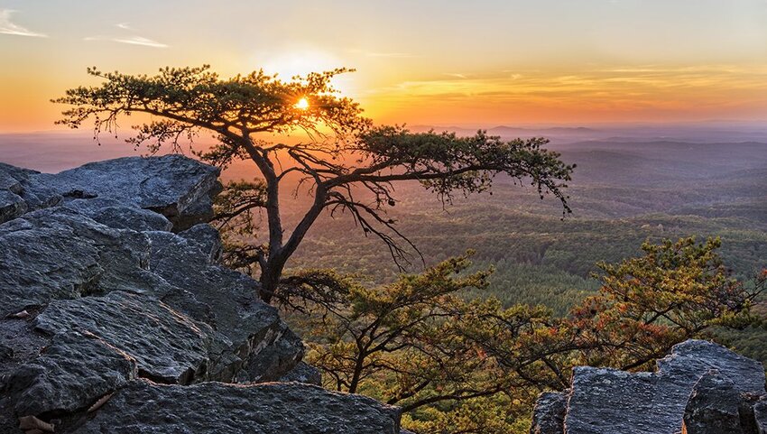
Cheaha Mountain is the dominant feature of Cheaha State Park, itself one of Alabama’s oldest state parks. The Creek Indians named the mountain ‘cheaha’, meaning high place, an apt name for the highest-elevation point in the state. At the summit is the Bunker Tower observation tower, from where visitors can enjoy views of granite boulders, wind-weathered trees, and the Appalachian Mountains. The tower, along with other structures scattered around the park, was built by the Civilian Conservation Corps (CCC) in the 1930s.
Alaska
Denali – 20,310 feet
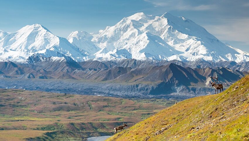
Rising majestically above its eponymous national park and preserve, Denali is the highest point in both the United States and North America. It forms part of the 600-mile-long Alaska Range between Alaska and Canada. Some people consider Denali to be the world’s coldest mountain due to strong winds and temperatures that have been known to drop to -93 degrees Fahrenheit. The landmark was called Mount Mckinley for almost a century, before changing to the local Koyukon people's name for it (which means "the Great One") in 2015.
Arizona
Humphreys Peak – 12,633 feet
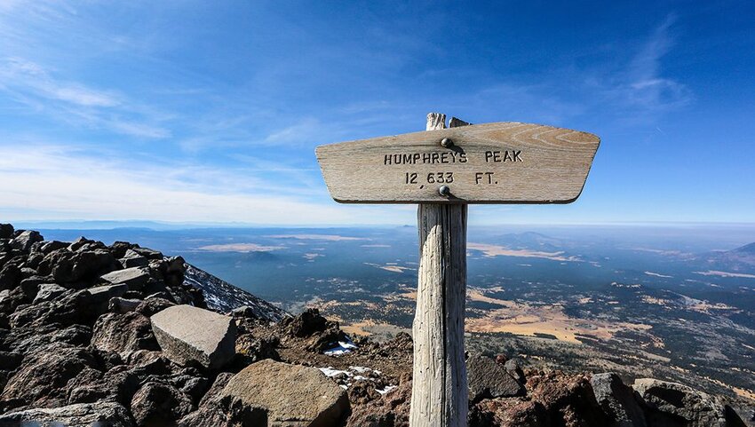
Situated in the Kachina Peaks Wilderness of the Coconino National Forest, Humphreys Peaks is the tallest point of a group of dormant volcanoes called the San Francisco Peaks in northern Arizona. On clear days, views from the summit reach as far as other state landmarks such as the Grand Canyon, Painted Desert, Oak Creek Canyon, and the Hopi Mesas. A notable feature around the peak is the presence of bristlecone pines. Scientists believe that this resilient tree can outlive any other known living organism.
Arkansas
Magazine Mountain - 2,753 feet
The flat-topped Magazine Mountain is a natural habitat for rare butterflies, including the bright orange Diana fritillary. What's more, an incredible 94 of the state’s 134 butterfly species inhabit the mountain. Two stories exist about the origin of the mountain’s name. One by English botanist Thomas Nuttall states that French hunters thought it resembled an ammunition storehouse (magazine). Another suggests that French explorers mistook a landslide for the sound of an ammunition explosion.
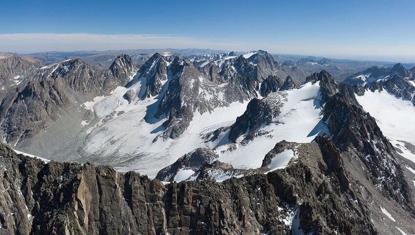
California
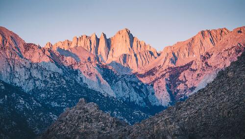
Mount Whitney - 14,494 feet
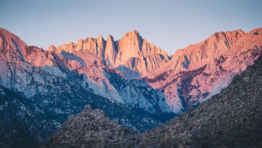
The tallest mountain in the “lower 48 states” and the highest point in the USA outside of Alaska is Mount Whitney. Characterized by its jagged ridges, this imposing mountain stands at the border of Sequoia National Park and Inyo National Forest. This is one of the most popular climbing and hiking destinations in the Sierra Nevada, with the shortest route being just over 10 miles. It’s also a common stopover for those walking all or parts of the iconic Pacific Crest Trail.
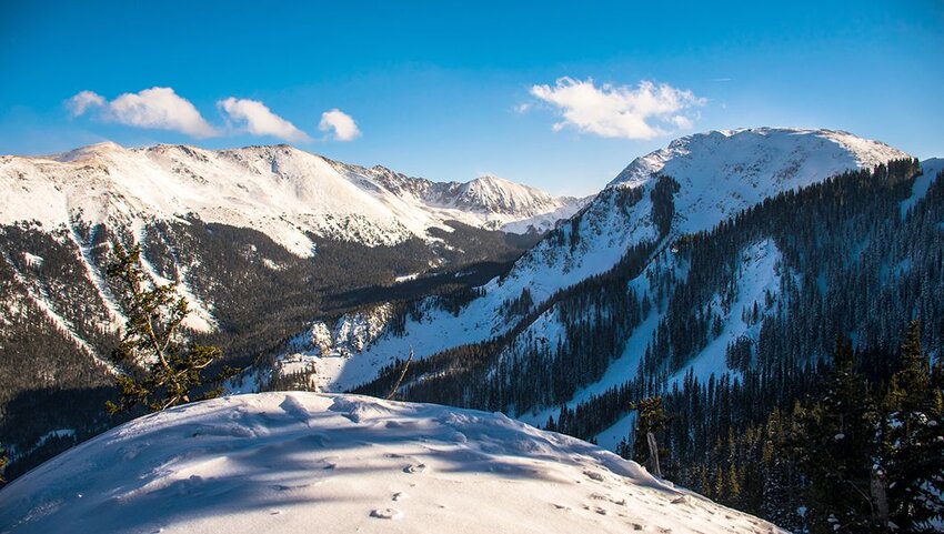
Colorado
Mt. Elbert - 14,440 feet
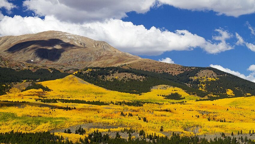
Being a state traversed by the Rocky Mountains and famous for its ski resorts, it seems right that Colorado is home to one of the highest points in the continental United States. Mt. Elbert is the tallest peak in the Rockies and the 14th tallest in the country. Yet, despite its imposing size, with correct acclimatization it’s recognized as a relatively easy mountain to climb. Five routes lead to the summit and those that make it to the top can enjoy views of other mighty state landmarks like the aptly named Mt. Massive.
Connecticut
Mt. Frissell (Southwest Shoulder) - 2,379 feet
Located at the tri-state border of Connecticut, New York, and Massachusetts, Mt. Frissell is a peak in the Taconic Range. While the summit (2,453 feet) is in Massachusetts, the south slope of the mountain marks the highest point in Connecticut. It’s crossed by the Mount Frissell Trail, which links up with the long-distance Appalachian Trail. Curiously, the mountain is the state's highest point but not its highest summit – that honor goes to Bear Mountain (with a summit of 2,316 feed).
Delaware
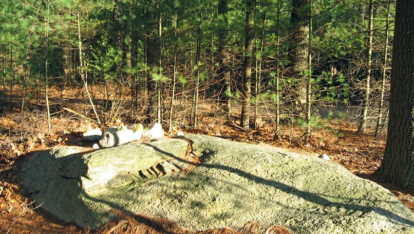
Ebright Azimuth - 448 feet

Not all state highpoints are cloudbusting mountains. Part of the Atlantic Coastal Plain, Delaware is distinguished by its flat terrain. Ebright Azimuth is a geodetic benchmark monument on a road near the city of Wilington. When the Delaware Geological Survey confirmed the highpoint, it closed a long running debate over whether this point or Centerville (446 feet) was the state’s highest elevation. Perched on the edge of the road, you won't find much here except a sign and a bench to mark the spot.
Florida
Britton Hill - 345 feet
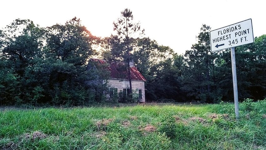
With much of its topography at or near sea level and also with areas inside the Atlantic Coastal Plain, Florida takes the prize for having the lowest highpoint in all 50 states. Highpointers have little concern for altitude sickness when visiting Britton Hill, which marks the summit of Lakewood Park in North Walton County. It isn’t the county’s only claim to fame, either. Stricklands Christmas Tree Farm is the birthplace of the The Panhandle Opry.
Georgia
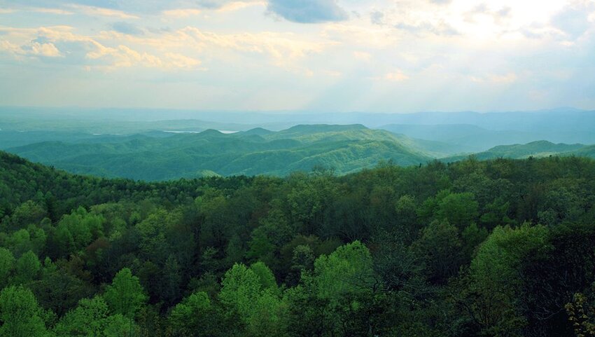
Brasstown Bald - 4,784 feet
Brasstown Bald is the focal point of the Brasstown Bald Recreation Center. It’s set amid the Chattahoochee-Oconee National Forests in northeastern Georgia. Visitors to this state highpoint find plenty to do besides enjoying the panoramic views. There’s picnic areas, an exhibition hall, mountaintop theater, and a general store selling local products. Those feeling energetic can also head off on one of three hiking trails.
Hawaii
Mauna Kea - 13,803 feet
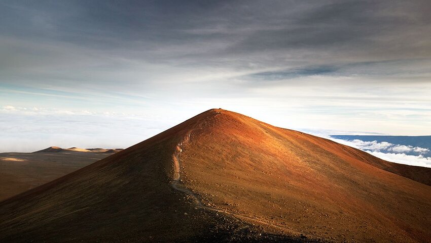
At the heart of Hawaii’s Big Island is Mauna Kea, a dormant volcano that last erupted over 4,000 years ago. The name translates to ‘white mountain’ and is a reference to the snow that falls on its slope for large parts of the year. As Hawaii’s highest point, Mauna Kea is an important center for scientific and astronomical research. Visitors can get a glimpse of this work via stargazing programs at the Maunakea Visitor Information Station.
Idaho
Borah Peak - 12,662 feet
Also known as Mount Borah, Borah Peak comes in at number 11 on the list of state high points. Located in the Lost River Range, it’s one of Idaho’s nine peaks that climb above 12,000 feet. Not only is this the tallest point in the state, it’s also its only active glacier. The peak received a boost in height of about one foot in 1983 following a magnitude 6.9 earthquake that hit the range.
Illinois
Charles Mound - 1,235 feet
Rural northwestern Illinois, otherwise known as the Driftless Area, is the location of Illinois' highest natural elevation. This region is geographically special because, unlike much of the country, it wasn’t covered by glaciers during the Ice Age. Charles Mound is also one of several highpoints that are part of a private property. For this reason it’s only accessible during daylight hours on weekends between July and September. Views at the top reach over the sprawling Illinois farm country.
Indiana
Hoosier Hill - 1,257 feet
Hoosier Hill is another state highpoint situated on private land. It’s found amid a forest in the midwest farmland near the Indiana-Ohio state line. It was here in 1936 that highpointer Arthur H. Marshall became the first person to visit the highpoint of every state (then 48). At the top of the hill is a mailbox covered in stickers left by the many travelers and highpointers that have visited over the years.
Iowa
Hawkeye Point - 1,670 feet
Once a place known only by locals, Hawkeye Point is now a popular and busy roadside stop on U.S. Route 60. The exact highpoint is marked by a mosaicked compass that portrays the map of Iowa. There’s directional signs pointing the way to all the other state highpoints, an observation deck, and a small hands-on history exhibition. Visitors thirsty for highpoint knowledge can find out more at McCallum Museum Osceola County in Sibley.
Kansas
Mount Sunflower - 4,039 feet
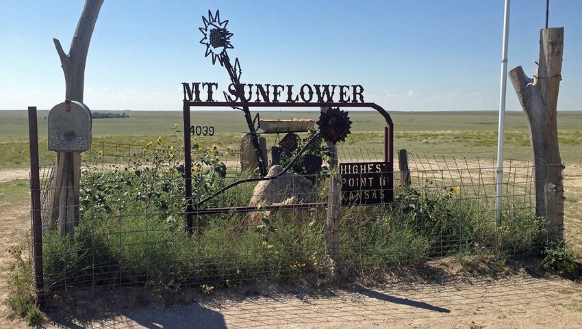
A private ranch in the High Plains landscape region of far-western Kansas is the setting for this state’s highpoint. Despite being a long way from the towering peaks of Colorado, Mount Sunflower has the Rocky Mountains to thank for its height. The High Plains area formed millions of years ago when sand, gravel, and other sediment was brought west from the Rockies by streams. The mount stands 3,300 feet higher than the state’s lowest point.
Kentucky
Black Mountain - 4,145 feet
Covered in northern hardwood forest, Black Mountain rises up from the Cumberland Plateau in the westernmost region of the Appalachian Mountains. Its elevation provides a natural habitat to numerous species of flora and fauna, including black bear and red elderberry. The area around the mountain has for long been known for coal mining. Head to the Kentucky Coal Museum, in nearby Lynch, to discover more about the history.
Louisiana
Driskill Mountain - 535 feet
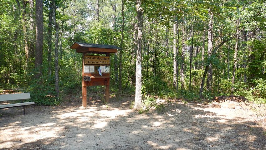
A gentle hike through a forest of pine and hardwood trees and seasonal wildflowers takes highpointers up to peaceful Driskill Mountain. This is the third lowest highpoint in all 50 states. In fact, it’s smaller than Louisiana’s tallest building, the 697-foot-tall Hancock Whitney Center in New Orleans. The mountain itself is a landform created by the erosion of unlithified Paleogene sediment.
Maine
Mount Katahdin - 5,269 feet
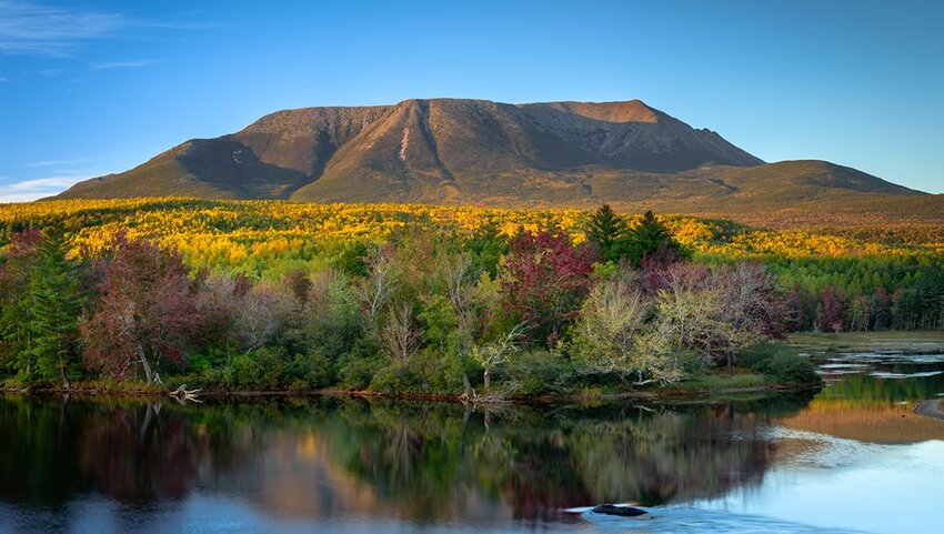
Mount Katahdin is the centerpiece of sprawling Baxter State Park in north-central Maine. Its name means ‘greatest mountain’ and was chosen by the Penobscot people. Today, the mountain is still deemed sacred by the Maliseet, Micmac, Passamaquoddy, and Penobscot nations. This is the northern terminus of the Appalachian Trail, and the area is famed for its challenging treks. Among the many routes to the summit is the short yet wild Knife Edge Trail.
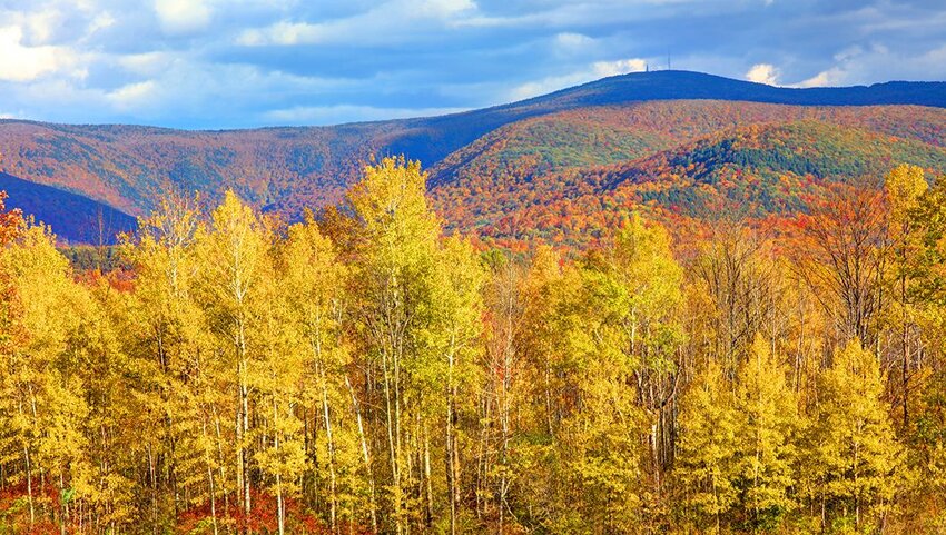
Maryland
Hoye-Crest - 3,360 feet
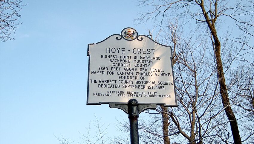
Maryland’s highest elevation point sits atop Backbone Mountain in the state’s most westerly region. The only way to reach Hoye-Crest is via a hiking trail that begins in neighboring West Virginia. At the summit there’s an historical marker and a picnic area. Visitors can also grab a certificate from a mailbox here. For more adventure, a short path leads to an obelisk that marks the Maryland-West Virginia state line.
Massachusetts
Mount Greylock - 3,491 feet
Located in Mount Greylock State Reservation in the state’s northwestern region, Mount Greylock is accessible via a scenic byway that connects the farmland of Lanesborough to the art-loving city of North Adams. Visibility from the summit extends for 90 miles, including into the states of New York and Vermont. There’s over 70 miles of hiking trails to explore plus cross-country skiing, snowmobile tours, and a museum.
Michigan
Mount Arvon - 1,979 feet
Mount Arvon is one of the must-see sights of the Huron Mountains in Michigan’s rural Upper Peninsula. The state’s official highpoint since 1982, it took the crown from Mount Curwood when the U.S. Geological Survey deemed it to be 11 inches taller. A highlight of a trip to this mountain in picturesque Baraga County is the bird's-eye view of Lake Superior. In winter, the summit is reachable by snowmobile or snowshoes only.
Minnesota
Eagle Mountain - 2,301 feet
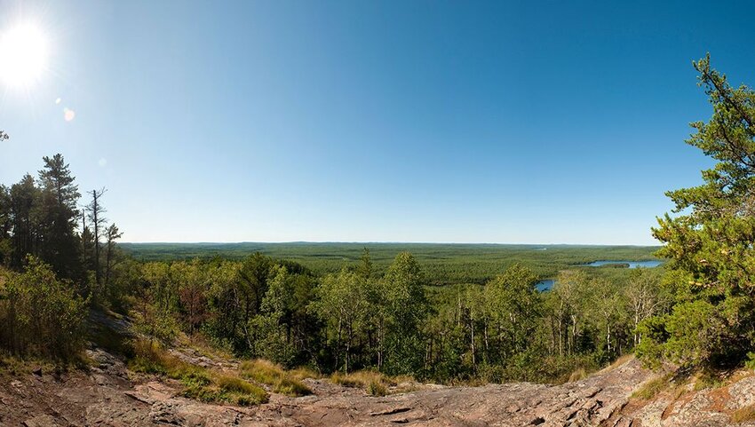
Eagle Mountain stands deep inside Minnesotra’s Superior National Forest and is accessed along the 7-mile-long round trip Eagle Mountain Trail. The trail traverses the Boundary Waters Canoe Area Wilderness and as such is a wild route and often overgrown. Self-issue permits are required to hike the trail and obtainable at the trailhead. Confusingly, there’s another Eagle Mountain in north Minnesota which is part of Lutsen Mountains ski resort.
Mississippi
Woodall Mountain - 806 feet
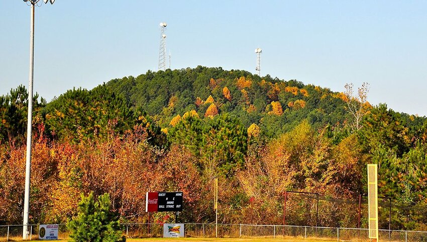
Just outside the city of Iuka in Mississippi’s northeastern Tishomingo County, Woodall Mountain has the honor of being recognized as the “bloodiest highpoint in the United States." On September 19, 1862, the mountain was the site of the Civil War Battle of Iuka. During the fight, General William S Rosecrans’ Union troops defeated the Confederates, led by General Sterling Price. A plaque at the summit provides details of the battle.
Missouri
Taum Sauk Mountain - 1,772 feet
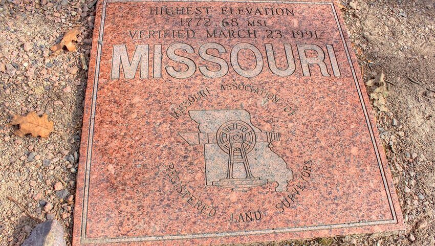
Head to the top of Taum Sauk Mountain State Park to stand at the highest point of Missouri. Set amid the St. Francois Mountains, the scenery of the 7,500 acre park is characterized by dense woodland and rocky glades. A lookout tower at the summit affords panoramic views of southern Missouri’s lush countryside. Several trails lead to and around Taum Sauk Mountain – Mina Sauk Falls Trail connects to the state’s tallest waterfall, 132-feet Mina Sauk Falls.
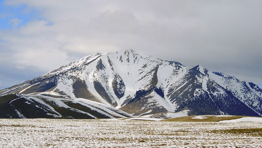
Montana
Granite Peak - 12,799 feet
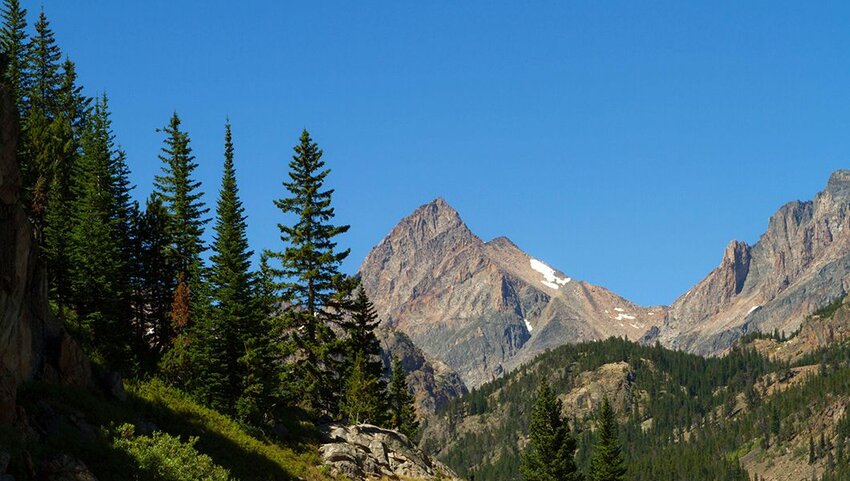
Isolated and imposing Granite Peak is everything that one should expect of a mountain. It’s the pinnacle of the Beartooth Range in south-central Montana. It’s also one of 28, 12,000-foot peaks in the Absaroka Beartooth Wilderness, which spreads from the state into Wyoming. The climb to the top is a challenging one and considered among Montana’s most adventurous treks. After several failed attempts, the first recorded ascent was in 1923.
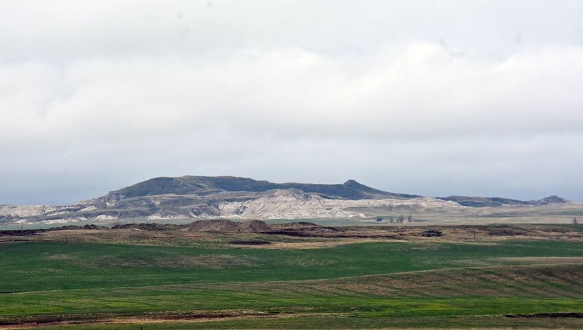
Nebraska
Panorama Point - 5,429 feet
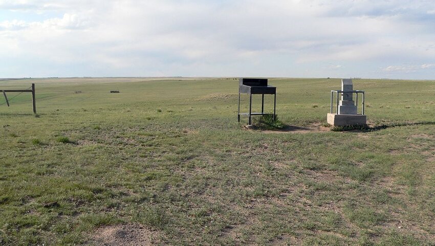
Wondrous views of big skies, far-reaching prairies, and three states are the reward for making it to Panorama Point. This highpoint is part of the Nebraska’s High Plains and in an area peppered with cattle ranches and farms. It’s located on a private ranch, thus a fee is required and visitors are warned to look out for free-roaming bison. Two Nebraska locals discovered the hill in 1951 using a World War I altimeter.
Nevada
Boundary Peak - 13,140 feet
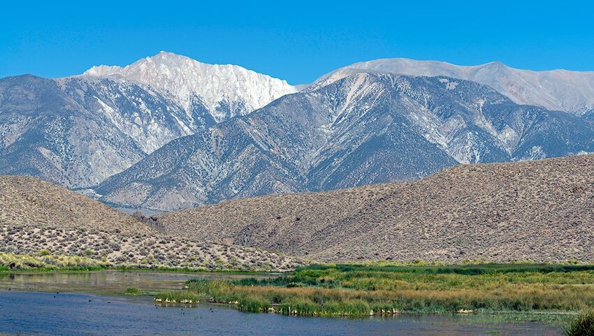
Boundary Peak in Boundary Peak Wilderness is the ninth highest state point in the U.S. From the top it's possible to see as far as landmarks such as Mono Lake in California and the Sierra Nevada Mountains. The peak stands at the northern end of the White Mountains and forms a twin peak with California’s Montgomery Peak. A variety of plants thrive around the wilderness, including alpine tundra, bristlecone pine trees, and juniper woodlands.
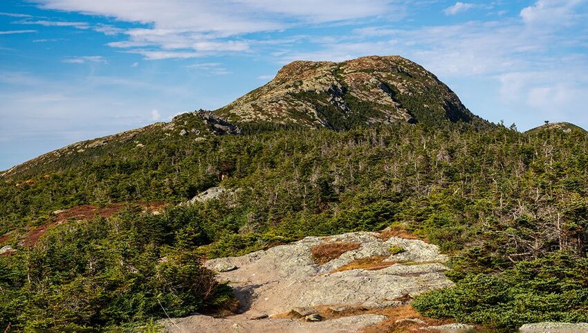
New Hampshire
Mount Washington - 6,288 feet
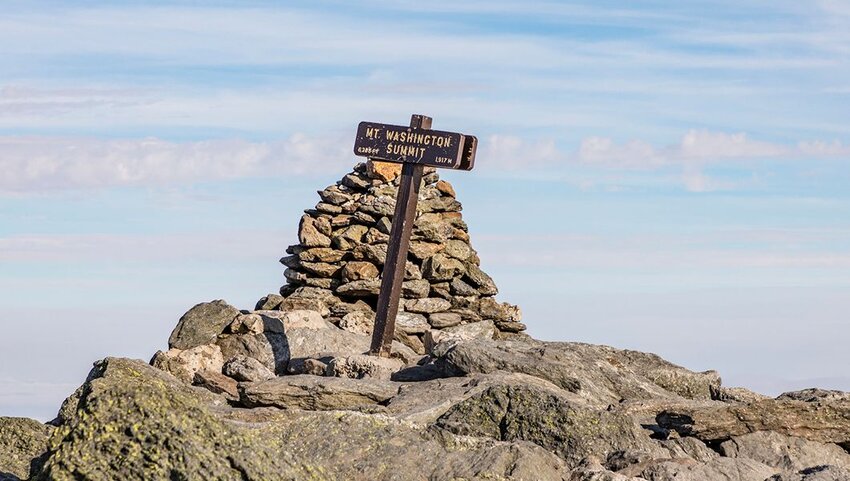
New Hampshire’s highest point is northeast North America’s tallest mountain. Mount Washington is known as Agiocochook by Native Americans, who believe it to be the home of the Great Spirit. The Mount Washington Cog Railway trundles through Mount Washington State Park to the top. Here, the Sherman Adams Visitor Center houses a cafe, museum, and observatory. Clear days afford views into Maine, Vermont, Massachusetts, and New York.
New Jersey
High Point - 1,803 feet
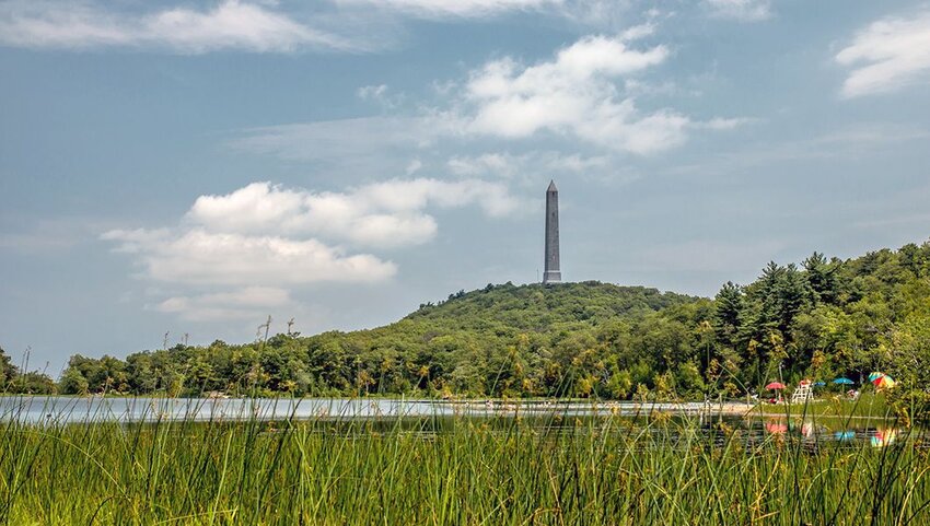
In northern New Jersey, the appropriately named High Point is the state’s highest elevation and the tallest peak in the Kittatinny Mountains. It stands at the top of High Point State Park, around which wind over 50 miles of multi-use trails. Dominating the summit is a 220-foot-tall war memorial called the High Point Monument – a 291-step staircase accesses a lookout deck. Also in the park are campgrounds, picnic sites, and an interpretation center.
New Mexico
Wheeler Peak - 13,161 feet
Rising up from the Sangre de Cristo Mountains, Wheeler Peak is the tallest mountain in New Mexico and eighth on the list of state highpoints. The 7.3-mile-long Wheeler Peak Trail meanders through the flora and fauna-rich Wheeler Peak Wilderness to the summit. Elk, golden eagle, and marmot, bristlecone pines, cottonwoods, and wildflowers are all present. Open year-round, the trail can be accessed by foot, horseback, and snowshoe.
New York
Mount Marcy - 5,344 feet
Mount Marcy is the commander in chief of New York state and the highest point of the Adironacks. Four main trails lead to the top, providing adventurers and highpointers with a range of challenges. Views from the summit, which shelters endangered alpine vegetation, reach over the entire Adironack range. Interestingly, President Teddy Roosevelt was climbing the peak when he received a message that he should travel to Buffalo to be sworn into office.
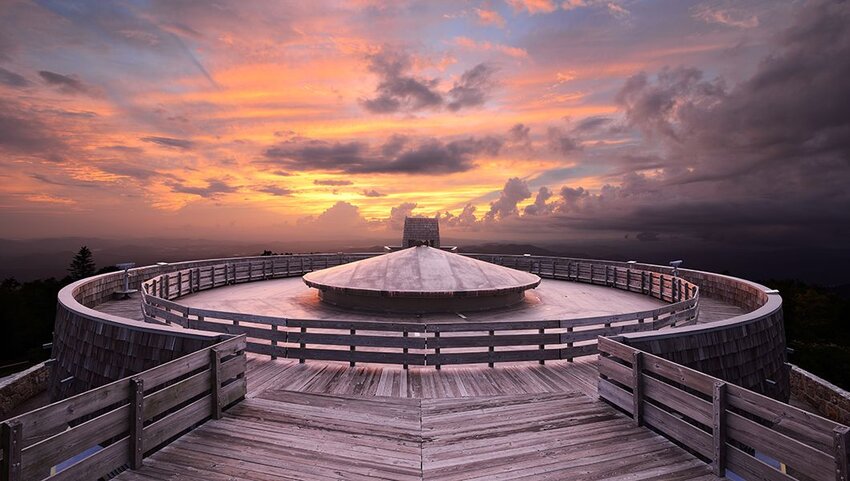
North Carolina
Mount Mitchell - 6,684 feet
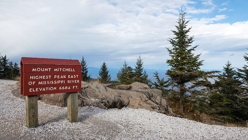
This state highpoint is a popular stop for those traveling through North Carolina along the scenic Blue Ridge Parkway. The crowning glory of Mount Mitchell State Park, visitors can drive to within a 10-minute walk of Mount Mitchell’s summit. The mountain is part of the Black Mountains, and named after the university professor Dr. Elisha Mitchell. Besides far-reaching views, visitors can learn more about the area at the Mount Mitchell Museum.
North Dakota
White Butte - 3,506 feet
Slope County, within the secluded and otherworldly Badlands of southwestern North Dakota, is the location of the state’s highest elevation. White Butte and nearby Rattlesnake Butte were once known as the Chalky Buttes due to their distinct color. The former consists of Oligocene age rocks from the White River and Miocene age Arikaree Sandstone. This is a similar geological makeup to the Badlands National Park.
Ohio
Campbell Hill - 1,549 feet
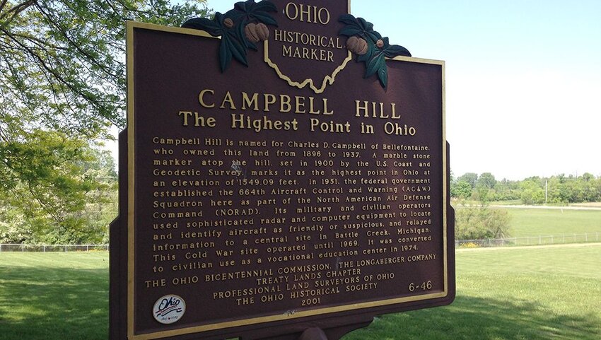
Campbell Hill is a glacial moraine situated on the outskirts of Bellefontaine in western-central Ohio. Once the site of the Bellefontaine Air Force Station, the hill is now part of the grounds of an educational campus. A simple flagpole marks the top, and there’s a guestbook and certificates. The surrounding area is rich in Indian folklore, as highlighted at the nearby Zane Shawnee Caverns.
Oklahoma
Black Mesa - 4,973 feet
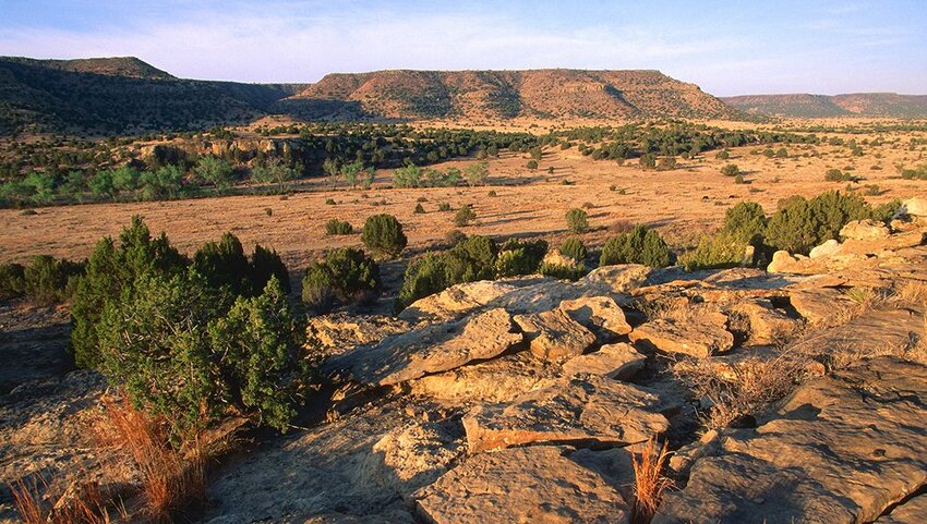
Oklahoma's tallest elevation is part of a ridge that extends into both Colorado and Nevada. Black Mesa is named after a layer of black rock lava that covers the ridge and appeared some 30 million years ago. Encompassed by the Black Mesa State Park and Nature Preserve, this is where the Rockies merge with shortgrass prairies to create a unique environment home to several endangered species. In August, it's also a perfect viewing spot for the Perseid meteor shower.
Oregon
Mount Hood - 11,249 feet
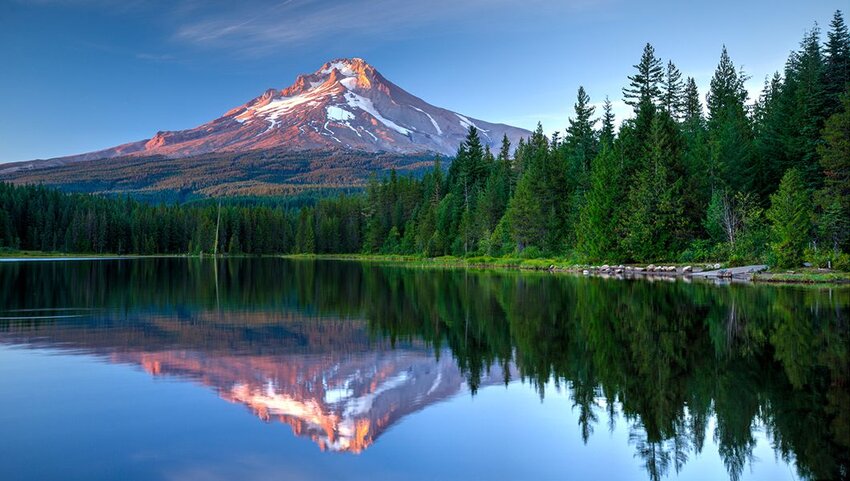
Mount Hood is a cloudbusting and dormant stratovolcano located within the Cascade Volcanic Arc – the last major eruption was in 1865. As the point of Oregon’s tallest elevation, it’s visible from Portland and is among the world’s most-climbed mountains. Four seasons of adventure await visitors to this state highpoint. On offer are endless miles of hiking trails, camping, fishing, and almost year-round skiing at Timberline Lodge.
Pennsylvania
Mount Davis - 3,213 feet
Forbes State Forest in Somerset County region of southwestern Pennsylvania is the home of this state’s tallest peak. Mount Davis takes its name from a Civil War veteran called John Nelson Davis. Prior to the war, Davis was a surveyor and naturalist with a love of mountains. A short trail leads from a picnic area to the summit and an observation tower. Views from here reach over the lush landscapes of the Laurel Highlands.
Rhode Island
Jerimoth Hill - 811 feet
It’s just an easy stroll along a 0.3-mile-long trail to the top of Jerimoth Hill in Foster, Rhode Island. But reaching the tallest point of the state wasn’t always straightforward. Legends abound of Henry Richardson, aka "The Madman of Jerimoth Hill". The one-time owner of the land around the hill, Richardson was notorious for making life difficult for highpointers. Today, however, the area is public property and freely accessible to all.
South Carolina
Sassafras Mountain -3,553 feet
Sassafras Mountain stands on the state border of the two Carolinas. Spreading all around are the pristine forest lands and pretty waterfalls of the 50,000-acre Jocassee Gorge. A lookout tower, which provides views of unspoiled wilderness for up to 50 miles, was installed at the summit in 2009. Keen hikers can stop at the mountain while walking the 77-mile-long Foothills Trail between Table Rock State Park and Oconee State Park.
South Dakota
Black Elk Peak - 7,242 feet
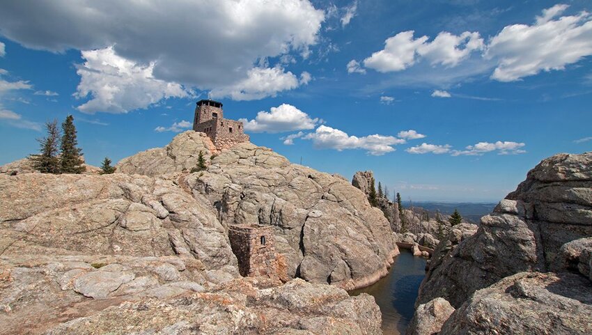
Enveloped by the Black Elk Wilderness in Cluster State Park, Black Elk Peak claims to be the highest point between the Rocky Mountains and the French Pyrenees. This highpoint in southwestern South Dakota is named after a medicine man of the Ogala Lakota people. Over a dozen routes lead to the summit, and there’s a trail suitable for all ages. The popular Little Devils Tower trail offers views of the Cathedral Spires and Mount Rushmore.
Tennessee
Kuwohi (Clingmans Dome) - 6,643 feet
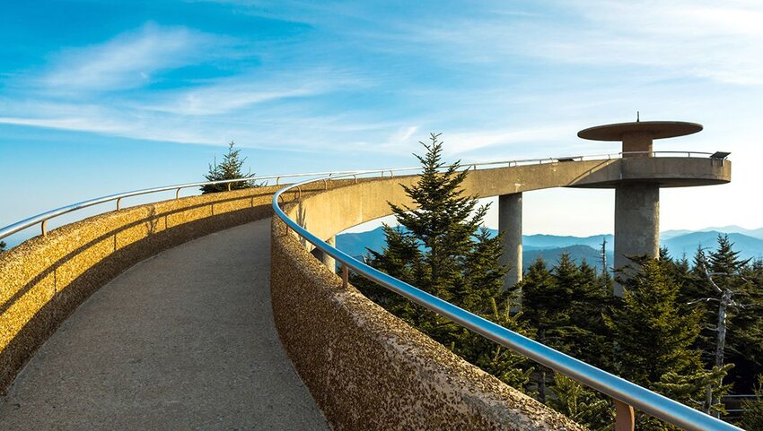
Rising above the treetops of the Great Smoky Mountains, Kuwohi (formerly Clingmans Dome) is the third tallest peak east of the Mississippi. A seven-mile road with scenic pullouts meanders through the park to a trailhead, from where it's a half-mile uphill walk to the top. On clear days, visitors can see into five states and for over 100 miles from the lookout tower. The Appalachian Trail crosses the area, marking the highest point on its route from Georgia to Maine.
Texas
Guadalupe Peak - 8,751 feet
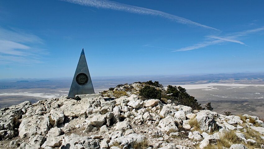
Guadalupe Peak is the “Top of Texas” and the crowning feature of Guadalupe Mountains National Park. It’s an 8.4-mile out-and-back trek to the top, which usually takes hikers between six to eight hours to complete. It passes some of the park's diverse ecosystems, such as the high desert and high elevation forests. Curiously, some 265 million years ago the Guadalupe Mountains were underwater and formed part of an inland sea.
Utah
Kings Peak - 13,528 feet
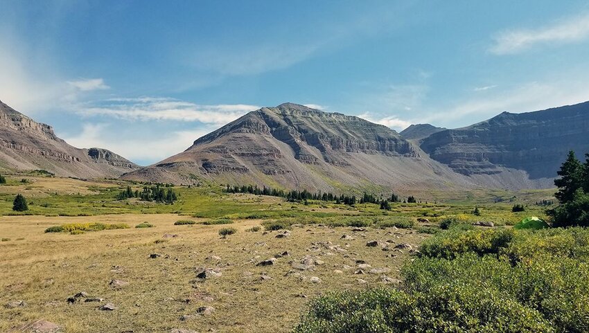
Resembling a shark’s tooth, Kings Peak is the seventh highest of the state highpoints and the tallest peak in the Uinta Mountains. It’s set amid the Ashley National Forest, in northeastern Utah, and is reachable along a 27-mile trail. While the route is achievable in a day, the breathtaking scenery calls for a multiday backpacking adventure. Overnight camping is possible at the nearby Alligator Lake and Dollar Lake.
Vermont
Mount Mansfield - 4,393 feet
Mount Mansfield, in northe-central Vermont, is one of the only mountains in the state that shelters alpine tundra leftover from the Ice Age. Part of Mount Mansfield State Park, it’s a dedicated National Natural Landmark. Besides hiking one of several trails, visitors can get to the top via the Gondola SkyRide. It departs from Stowe Mountain Resort, which in winter welcomes powder hounds with 450 acres of skiable terrain and 40 miles of runs.
Virginia
Mount Rogers - 5,729 feet
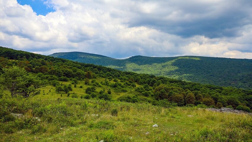
A nine-mile out-and-back hike traverses the spruce forests, wildflower meadows, and rocky outcrops of Mount Rogers National Recreation Area. Mount Rogers itself is nestled among the 500 miles of hiking, biking, and horseback riding trails in the area. Drivers can also explore the region via the Mount Rogers Scenic Byway. This highpoint is named after Virginia's first State Geologist and Massachusetts Institute of Technology (MIT) founder, William Barton Rogers.
Washington
Mount Rainier - 14,410 feet
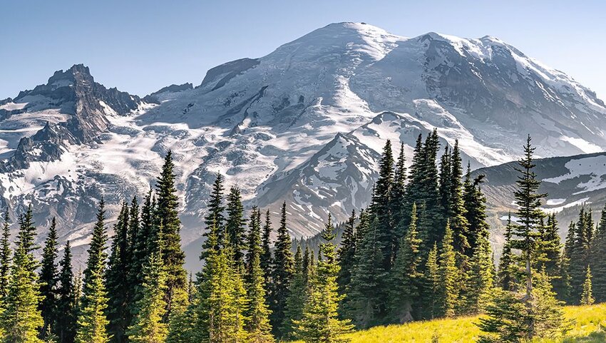
The highest mountain in the Cascade Range, Mount Rainier is an active volcano and the most glaciated peak in the contiguous U.S. This snow-capped landmark rises above Mount Rainier National Park and presents a daunting challenge for climbers. For the less experienced, the 368-square-mile park has dozens of trails that weave through wildflower meadows and ancient forests. The Paradise area has epic views and several trailheads.
West Virginia
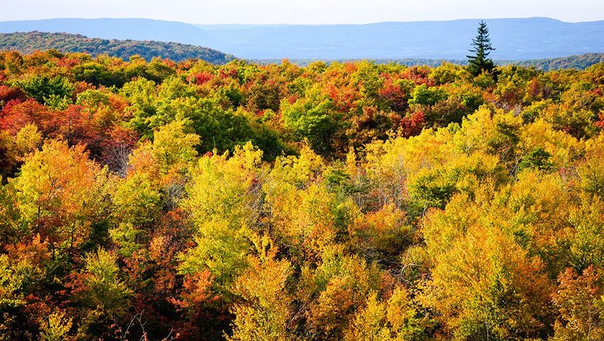
Spruce Knob - 4,863 feet
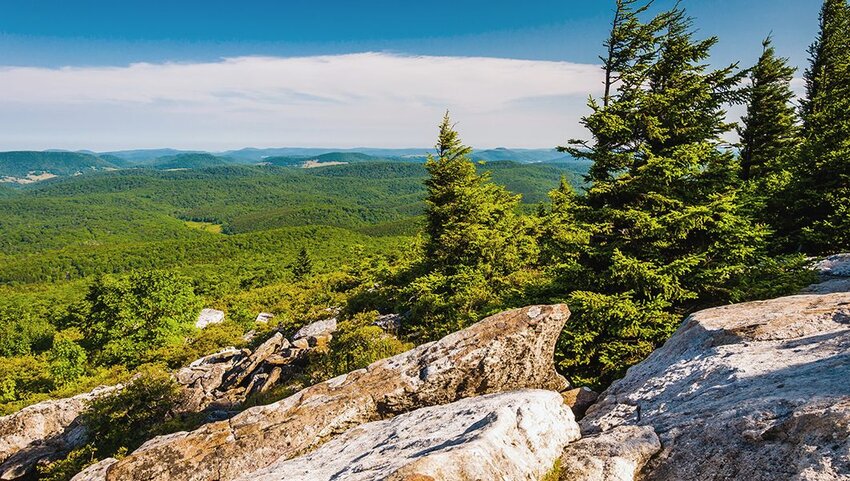
Spruce Knob, the pinnacle of Spruce Mountain, is the highest point in both West Virginia and the entire Allegheny Mountains. This alpine peak presents abundant backpacking and hiking opportunities, most notably the Whispering Spruce Trail. The half-mile route circles the knob, offering sweeping views of the Spruce Knob-Seneca Rocks National Recreation Area, and providing information about local geology, flora and fauna via interpretive signs.
Wisconsin
Trimms Hill - 1,951 feet
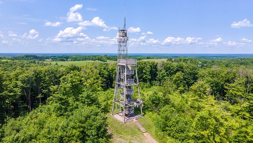
Situated in the aptly named town of Hill in northern Wisconsin, the state’s highpoint is the centerpiece of Timms Hill County Park. From a lookout tower at the top of Timms Hill, views stretch for 30 miles over the forests and lakes of the Northwoods region. A popular recreational area, the park surrounding the hill features a fishing pier, swimming beach, and picnic grounds. In winter it’s open for cross-country skiing, snowmobiling, and snowshoeing.
Wyoming
Gannett Peak - 13,804 feet
Head to the isolated Wind River Mountain Range in northern Wyoming to find what is deemed by mountaineers as one of the most difficult state highpoints to reach. Gannett Peak is the tallest peak in the Rockies outside of Colorado. Climbing it involves crossing high altitude mountain passes and glaciers, including the 896-acre Gannett Glacier. Many adventures include the peak on a trip along the Continental Divide National Scenic Trail.