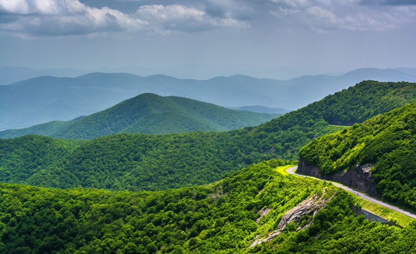
The Blue Ridge Parkway is the most visited National Park site in the country. Many come to drive the parkway and enjoy the mountain vistas with their signature blue hue that seems to go on forever into the distance. The curving road passes through tunnels and varying scenery like huge rock cliffs or walls of rhododendron and mountain laurel. And the overlooks that dot the parkway are popular places for a picnic or to watch the sunset or sunrise.
Another way to enjoy this national treasure is by hitting the trail. There are plenty of hikes to choose from along the parkway, but these 10 lead to some of the most beautiful waterfalls and viewpoints you can find in North Carolina. Before heading out on your adventure, know that cell service is spotty in the area so be prepared with directions and a game plan. You’ll also want to check the National Park Service website if you’re visiting during the colder months because sections of the parkway close during the winter.
Devil’s Courthouse
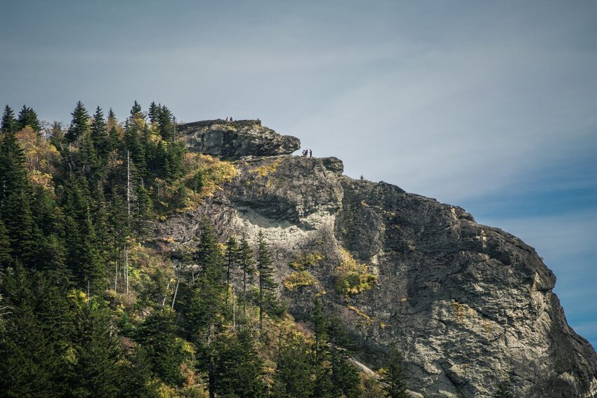
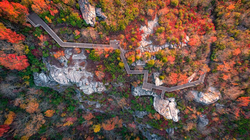
If you want to feel like you’re walking through an enchanted forest, then Devil’s Courthouse is for you. As you enter the woods, pine trees tower around the trail and moss covers the ground as far as the eye can see. The path is paved for two-thirds of the way up though that doesn’t mean it’s easy – the mile-long trail is very steep.
There’s a very rocky path after the paved section, followed by a set of large stairs that take you the rest of the way up to the mountain top. And at the peak, you can see into three other neighboring states on a clear day. A platform made almost entirely of jagged rocks makes the perfect viewing area, but don’t cross the rock wall or veer off the trail. This area is full of delicate and endangered plant species, and the space below the rock wall is home to a nest of peregrine falcons.
There’s ample parking for this hike (found at milepost 422) and the lot looks up at the peak where you’re headed. Bring a picnic lunch and you can use the picnic table overlooking the mountain peaks in the distance and the valley below after your hike.
Graveyard Fields
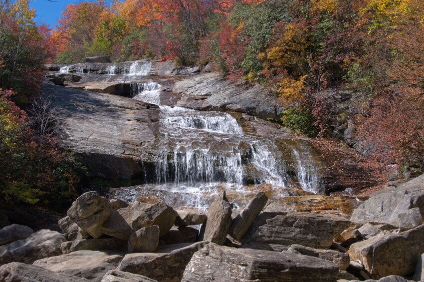
Named many years ago after a wind storm tore through the area and left a slew of tree stumps resembling gravestones, the varied terrain and two waterfalls make this a very popular hike in the warmer months – especially for families as you can make this a short out-and-back hike to Lower Falls or hike the entire loop trail.
The loop is about 3.5-miles, but to reach the waterfalls you’ll have to take two different off-shoot trails. It’s only 0.3-miles from the parking area to Lower Falls, but the Upper Falls are reached from a 0.8-mile off-shoot trail that includes a river crossing. Along this route, you’ll walk across boardwalks and bridges, and through rolling fields, as well as rhododendron thickets.
There’s a large parking lot and bathroom facilities at milepost 418.8, but keep in mind that the bathrooms close seasonally. There’s a trail on the left and right side of the parking lot and both enter the Graveyard Fields Loop. Make sure to take a photo of the map at the trailhead too as the Upper Falls off-shoot trail isn’t very well-marked.
Bluff Mountain Trail
Like Graveyard Fields, the Bluff Mountain Trail also goes through varied terrain, but unlike Graveyard Fields this one includes multiple mountain overlooks. The entire Bluff Mountain Trail is 7.5-miles, but you don’t have to hike the whole route. For a great half-day hike, start at Alligator Back Overlook on the parkway at milepost 242 and then make a left onto the Bluff Mountain Trail. This takes you up to The Bluffs Overlook and then on to the parking area in Doughton Park.
You can also make a detour out to a small trail shelter then make your way back through Doughton Park to the parkway and walk along the road back to your vehicle – the entire trail runs from the Brinegar Cabin to Basin Cover Overlook. The parking lot for the picnic area of Doughton Park closes during the winter months so make sure to take that into consideration when planning.
Fryingpan Mountain Tower
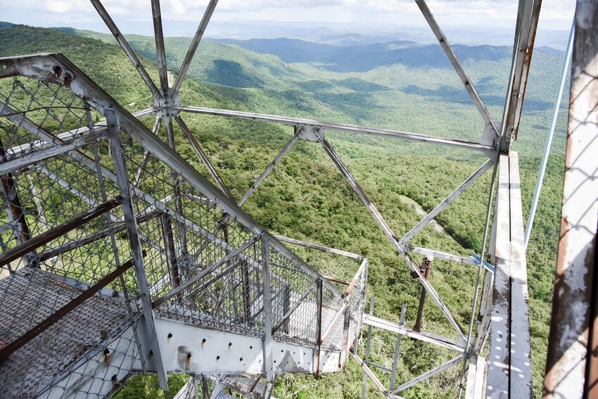
Fryingpan Mountain Tower Trail takes you up to some of the most expansive views of the parkway. The entire hike follows a wide gravel fire road, but the slope is relatively steep and categorized as moderate. Just before you reach the fire tower, you’ll pass multiple radio towers, so make sure to follow the signs and stay out of restricted areas.
The highlight of this dog-friendly hike is climbing the 70-ft tower – the bottom flight is a bit wobbly but becomes more stable once you reach the first landing. The top level of the tower is closed off, but you get 360° views from the final landing, which is the perfect spot to take in a windy sunrise or sunset. And while there isn’t a typical parking lot for this hike, there is a gravel pull-off on the side of the parkway with a gate in front of the fire road.
Mount Pisgah
As one of the most recognizable peaks from the city of Asheville, this is a popular trail for those in search of a challenge. The moderate/strenuous 2.6-mile round trip takes you to the 5,721-foot summit of Mount Pisgah. Along the way, you’ll be able to see the Fryingpan Mountain Lookout Tower, Cold Mountain, and Looking Glass Rock on a clear day.
While the views are better from Fryingpan Tower, this hike is longer and more scenic – the wooded trail takes you through dense mountain laurel, rhododendron, and a blanket of wildflowers in the summer. You’ll find the lot for this hike at milepost 407.6, but instead of being right on the parkway, you’ll need to take the turn for the Mount Pisgah Overlook and then go through the parking lot for the Buck Spring Gap Overlook. The trailhead is on the opposite side of the next parking lot.
Craggy Pinnacle
Take this hike on a weekday or very early or late on the weekend. It’s short, labeled as easy/moderate, and one of the closest hikes to Asheville that leads to almost 360° views of the Blue Ridge Mountains. As a result, it’s very popular with families who have smaller kids. But besides being one of the more accommodating trails on the parkway, Craggy Pinnacle is also known for the stunning rhododendron blooms in June and the wild blueberries that can be found along the trail in late summer.
The hike leads you through a thicket of rhododendrons before presenting a fork in the road. Go left for a rocky viewing platform complete with benches and a rock wall boundary where you can see the visitor center and winding parkway below. Go right for views with more of a wilderness feel as there are no boundaries here – it’s also where you’ll find most of the blueberries. The parking lot for this hike at milepost 364.1 is very big, but still gets full on the weekends and weekdays during peak season. People around here really love their blueberries, ya know?
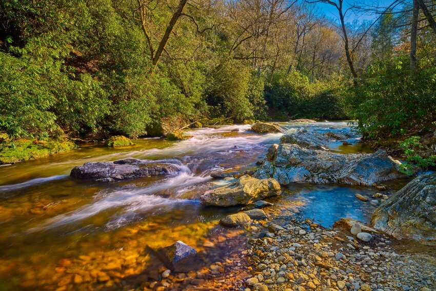
Crabtree Falls
Crabtree Falls isn’t the easiest to reach, however, it’s easily one of the most beautiful waterfalls on the parkway. The trail is only about three miles long and the way down to the waterfall is no problem, but climbing out the other side is a different story. The steep switchbacks are a doozy, but can be tackled as long as you take your time. If you don’t want a workout, however, you can always return the way you came.
Along the way, you’ll walk by the Crabtree Falls Campground, but the majority of the hike meanders through tranquil wooded areas. Prepare to stay at the base of the falls for at least a few minutes – the rushing water cascading 70 feet down the rocky mountain face truly is something to behold, and it’s a great place to enjoy a snack. You’ll find the large parking lot at milepost 339.5 next to a now-abandoned store, and keep in mind that it gets very hot and muggy down near the waterfall during the summer so bring plenty of water and try to go early.
Linville Falls
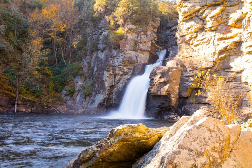
Super accessible (for the parkway) and home to a variety of hikes for different levels, Linville Falls is one of the most popular waterfalls along this road. At milepost 316.4, you’ll find the visitors center where there are restrooms and two different trailheads that lead to the falls. The easier trail is the Erwin’s View Trail, which gives a bird’s eye view of the Upper and Lower Falls. There are two different side trails here: the Upper Falls Trail gives you a close-up of the two Upper Falls and Chimney View Trail provides another location to view both Upper and Lower Falls.
The strenuous trail that leaves from the visitors center is the Linville Gorge Trail where you can stand right at the pool at the base of Linville Falls. While the current below the waterfalls is too turbulent for swimming, it’s the perfect place for a picnic while lounging on the large boulders. This trail also takes you to the Plunge Basin Trail where there’s a nice overlook of the Lower Falls. If you have a chance while you’re out this way then you need to take Old NC-105 a little further out to Wiseman’s View where you can take a short, paved trail out to a platform with views of the gorge and Tablerock and Hawksbill Mountains on the opposite side.
Rough Ridge
Grandfather Mountain and a fun photo opp bring many people to hike Rough Ridge. At sunrise, you can watch the soft sunlight first touch those mountains and in the summer the trees are so green that it almost looks surreal. There are two major stops on this trail – a viewing platform for Grandfather Mountain and then a jagged rock outcropping where many people take their photo to make it look like they’re hanging over a ledge.
This hike isn’t too difficult, but you do traverse some unstable rocks so you have to watch your footing and wear hiking boots if you have them. Rough Ridge is also very popular with college students as the hike is close to Boone where Appalachian State is located and weekends bring a crowd in every season except winter. The lot is pretty small for this hike, but if you continue traveling north about a half-mile, you’ll find the Boulder Field Parking area where you can access the Tanawha Trail that takes you up to Rough Ridge Overlook.
Boone Fork Trail
Rhododendron tunnels, multiple waterfalls, and wildflowers are just a few things that draw people to this trail in the High Country. The hike begins in Julian Price Memorial Park at milepost 296.4 where there’s a large picnic area, ample parking, and restrooms. The trail then follows two creeks for a majority of the way with multiple creek crossings as well as a short ladder to climb. There are lots of roots and rocks along the way so hiking boots are a nice asset on this trail as well.
In the summer, dip your feet in the creek for an easy way to cool off and make sure to take advantage of all the places along the trail to stop for a break and hang up a hammock for a lazy afternoon. Keep in mind that Boone Forkl can get incredibly muddy and the stream crossings very tricky after heavy rain, so try to plan your visit for the drier season.