WE KNOW THERE ARE QUESTIONS AROUND TRAVEL AMID THE CORONAVIRUS (COVID-19). READ OUR NOTE TO READERS HERE.
With paper maps becoming a thing of the past, more people are relying on smartphones for navigation. A great navigation app can take all the stress out of travel by offering various types of transportation routes to choose from. It’ll provide turn-by-turn directions, traffic updates, alternative routes, timeframes, and more. Many navigation apps work offline too, so there’s no need to worry about finding WiFi. Here are five navigation apps your phone is missing.
AllTrails

If you plan to hit the backcountry to go hiking, mountain biking, or trail running, then AllTrails is your window to adventure. The app offers access to over 100,000 hand-curated trails located in more than 150 countries, independent states, and islands. Each trail comes with detailed instructions, user reviews, and original photos. You can select from a host of different criteria including distance, fitness level, trail type, and suitability for children and dogs. You can even save trails in personalized lists to come back to at a later date and record your statistics. AllTrails is available for free on Android and IOS. For only $30 per year or $100 for life though, you can unlock additional tools such as offline GPS mapping and real-time satellite weather and air quality updates.
Citymapper

Although Google Maps and Apple Maps are excellent for navigating a city’s transportation system, neither of them quite match up to Citymapper. The reason why is because Citymapper focuses solely on providing real-time public transportation guidance. It collects information from open data and local transit authorities in order to suggest the best bus, subway, train, walking, and combination routes to your desired destination. You’ll also receive suggestions as to which subway cars and station exits are best for your journey. Another useful tool is advice on bike, car, and scooter sharing systems. Citymapper is available for free on Android and IOS. It is presently functional in 40 cities in North, Central, and South America, Australia, Asia, and Europe.
Komoot

Komoot is another excellent option for cyclists, hikers, and mountain bikers and works in 80 countries worldwide. From asphalt roads perfect for cycling to all-terrain mountain bike tracks and countryside paths, the app covers every imaginable scenario. You can customize your routes to feature the exact things you want to see and do along the way and follow turn-by-turn voice directions. Everything functions offline, so there’s no issue with coverage when you are at high altitudes or in remote areas. Save all of your trips to view at a later date and compare your stats. Komoot is available for free on Android and IOS. The free app includes one free region to be selected from across the globe. Additional single regions cost $3.99, region bundles cost $8.99, and all regions cost $29.99.
Roadtrippers

Do you have a road trip on the horizon? Roadtrippers makes plotting your journey a seamless task. Simply enter the start and finishing points of your journey and then let the app suggest offbeat places to discover along the way. You can choose what you want to see and do according to various categories and all suggestions will be within 10 to 30 minutes of your principal route. Once you’ve made your selections, they’ll be added to a map alongside estimations for distances, times, and fuel costs. Plan trips with your friends and delve into an archive of pre-loaded itineraries. Roadtrippers is available for free on Android and IOS. The app can currently map road trips in Australia, Canada, New Zealand, and the U.S. Get Roadtrippers Plus for $6.99 per month or $30 per year to benefit from the ability to save unlimited trips plus discounts on car rentals, hotels, and much more.
SeaNav
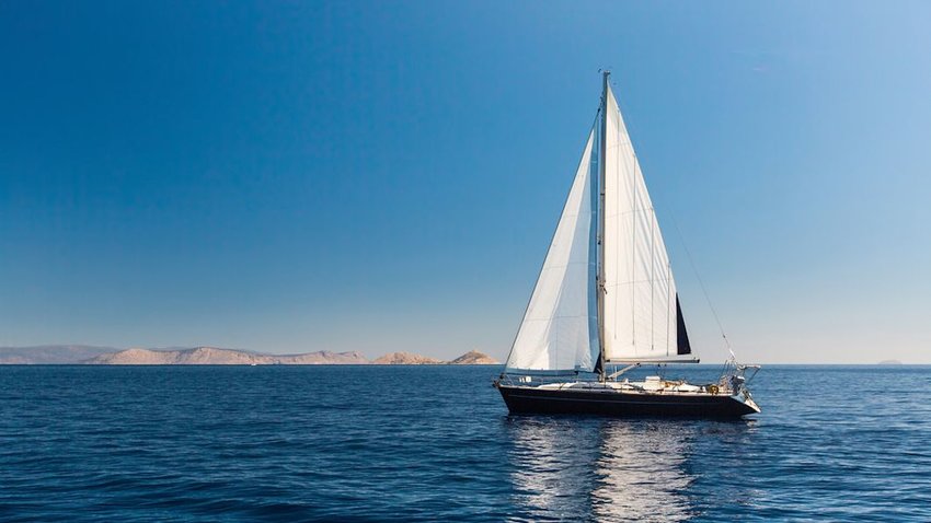
Whether you're sailing the Atlantic or Pacific, SeaNav by Pocket Mariner will get you where you want to go. There’s two versions of this Apple IOS app. SeaNav US uses National Oceanic and Atmospheric Administration (NOAA) charts for navigation around the U.S., Canada, and the Great Lakes. SeaNav UK sources charts from the U.K. Hydrographic Office (UKHO) for coverage in the United Kingdom and Ireland. The U.K. version also has information for Belgium, Denmark, France, Germany, the Netherlands, and Spain. App features range from route planning and real-time tracking with Waypoints to offline charts and a free Apple Watch app. There’s a live augmented reality camera view and an automatic identification system (AIS) for collision alerts.